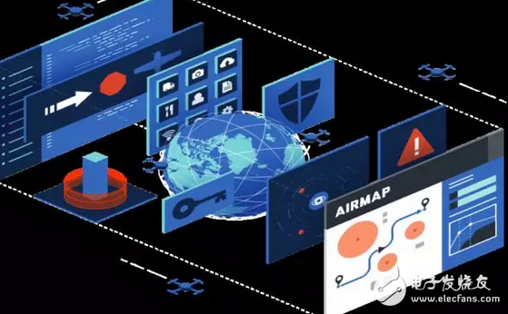
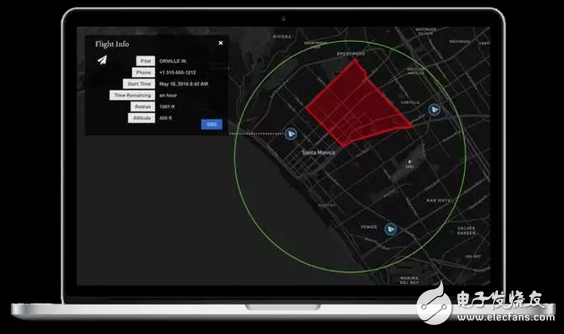
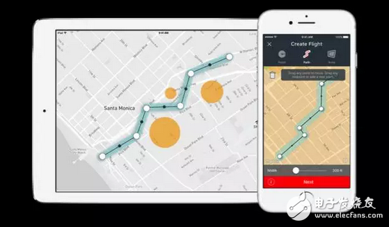
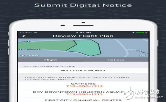
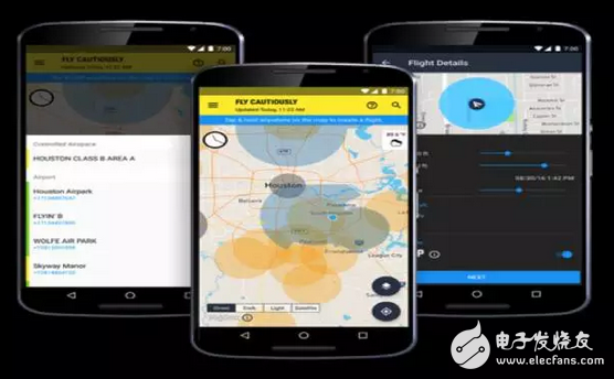
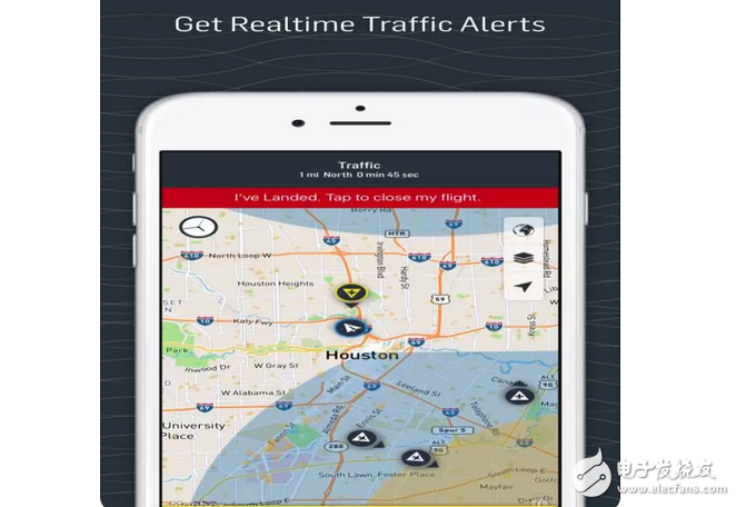
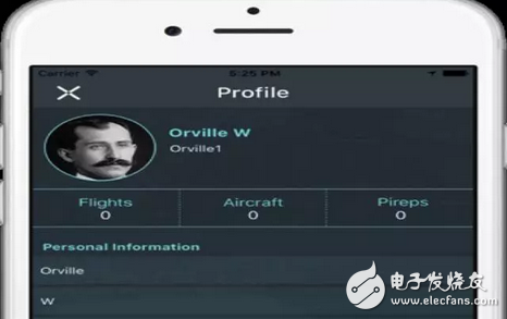
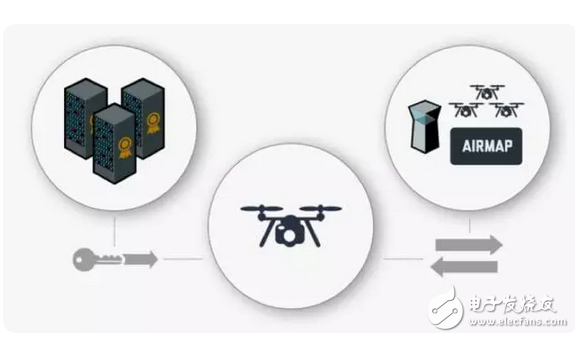
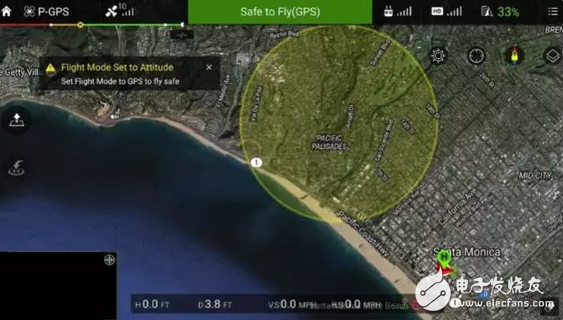
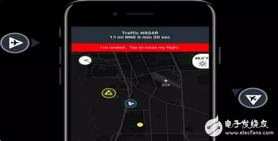
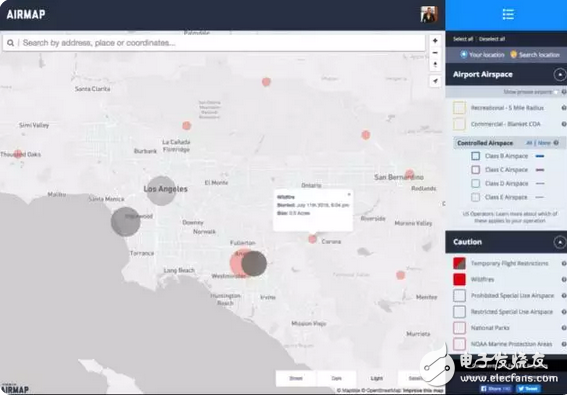
Recently, Wal-Mart launched the drone "smart bird" to deliver goods to customers! This greatly saves customers time to find goods and silly waiting for the clerk to pick up the goods! In fact, as early as 2015, Amazon tried drone delivery, and domestic Jingdong also followed the pilot to try to use drones to deliver the last mile. (Amazon drone delivery) However, this bird can be used for more than just delivery. It can also be used for disaster relief, agricultural insurance, military operations, medical care, film and television aerial photography, environmental protection, remote sensing mapping and so on! Even after taking a photo tour, you can use it! However, the problem came at hand - flying in the sky is easy, how to make the drone safely fly home? When it comes to drones, I have to mention the good brothers of the matching - intelligent air navigation navigation map Airmap! Founded in 2014, Airmap, headquartered in Santa Monica, USA, is a free mobile app for airborne navigation for drone operators, dedicated to low-altitude management of drones. To put it simply, it is to tell the commanders who drive drones which sites you can fly, which ones can't fly, or which routes fly faster, and where there are too many flying partners. But don't underestimate it. This app can complete the navigation of 100,000 drones per day. It also provides drone traffic management solutions such as geo-protection, remote ID verification, and flight avoidance. The original intention of Ben Marcus to create this company stemmed from his keen sense of the drone industry. Ben, who grew up on the edge of Santa Monica, loved airplanes since he was a child. He likes to watch the planes at the airport. At the age of 18, he became a local flight instructor and taught people how to fly. After studying airplane technology at Purdue University, he went to Tom's Aircraft for aircraft sales. It can be said that his life is associated with the aircraft. In 2014, he realized the potential of the drone market and found that Amazon, Alphabet, and Facebook all began to focus on the development of the airspace. He believes that drones are not only simple to fly in the sky, he feels the need to establish an airspace management platform, the later Airmap, to make flights safer, more efficient and faster. In order to better understand the norms and policies of the development of the drone market, Ben Marcus recruited Gregory McNeal, a professor of law and public policy at Pepperdine University, who is also a technology, crime, security-related field and drone. Experts in the field have done a decade of research on drone policy, and have provided a lot of policy recommendations for Airmap. Under the efforts of the team, Airmap independently developed the DNAS system (Digital NoTIce and Awareness System) to send the external environment information of the flight to the drone operators and airspace related parties. The airport that has already registered the D-NAS system has been More than 125 homes. Easy to control drone flight The entire Airmap app is very easy to use and can be easily used to develop a safe flight plan: Step 1: Open the app to create a flight Use the roadmap tools on the Airmap airspace and ground maps to plan a flight while helping you to understand the air traffic conditions and flight conditions. Step 2: Send a notice to the nearby airport to fly over the drone When you want to operate a drone to fly within 5 km of the airport, the APP will alert the airport system that you only need to click on the digital notice to start the flight. Step 3: View the traffic details during the flight of the drone This is similar to the Gaode map, which will plan a flight route for the user. The road areas that will pass during the flight will be displayed on the map one by one. Step 4: Get a reminder of air traffic conditions during the flight For example, when driving on the ground, the navigation app we use will also give the user a reminder of the traffic ahead. When the flight path of a manually piloted aircraft may pose a danger to the drone flight, the APP will issue a warning "There is an airplane in front! There is an airplane in front!" Step 5: Improve the drone data Each aircraft has a number, and drones are no exception. You can give your drone a name. The drone also has an ID In addition, in order to allow each drone to be better identified and monitored. Airmap and DigiCert, a company dedicated to providing customers with SSL certificates and management tools, have publicly issued SSL (Secure Sockets Layer)/TLS (Transport Layer Security Protocol) certificates, which can be used to obtain drone identification and digital certificates. Authorize and complete drone decoding. At the same time, this is the world's first drone digital certificate! Drones play a big role Let drones help more people, Airmap intelligently integrates the resources of the drone market. Airmap has extensive cooperation with other companies, including DJI, the leading company in the UAV, and 3DR, Intel, SenseFly, etc. In the United States, 300 wildfires occur every day. Airmap works with China's Dajiang Company to embed real-time wildfire warning information into geo-protection data to better authorize drones to perform fire and fire-fighting operations, or to bypass dangerous routes and avoid accidents. Flight accident. At the same time, Airmap directly obtained information from the US Department of the Interior's accident command system, and immediately transmitted the flight control information of DJI to the drone through the Airmap Apple and Web version of the API and geographic protection system. These data contain wildfire information that is more timely than temporary air traffic control (TFRs) issued by Federal Aviation Administration. Let drones fly safer Through the Airmap platform, the flying hands can see the real-time drone location and the external environment of the drone. Not only that, but Airmap also works with PASSUR (air traffic control platform for manned aircraft) and weather company uAvionix (developer for Ping ADS-B sensor). Ben said: "In order to ensure the safety of the flight plan, we need a lot of air data. These flying sensors are far from enough, such as population density, building height, wildfires and emergencies, social activities, low-altitude weather. It is the factor we need to consider." For example, when there is social collective activity, the drone needs to know which areas to fly around... or the president is visiting the town at this time, knowing that the group of Secret Service members do not like to have drones flying around. At present, Airmap has solved the problem of transmitting special action information to drones, and is working on implementing zero-operator or no-supervised flight research. The prospective APP is naturally favored by investors. In February 2017, Airmap received a $26 million Series B investment led by Microsoft Ventures. For the future development of Airmap, Ben Marcus revealed in an interview in February this year that Airmap plans to set up a new office in Berlin, Germany and NASA Ames Research Center, dedicated to global airspace management. Ben Marcus also ridiculed that in the near future, maybe we will fly to work instead of driving, we look forward to that day! According to the different backlight sources, LCDs can be divided into two types: CCFL displays and LED displays. Lcd Module,Kortek Tft Lcd Monitor,Game Boy Color Tft Lcd Kit,A-Si Active Matrix Tft Lcd Shenzhen Newvision Technology Co.Ltd , https://www.newvisionlcd.com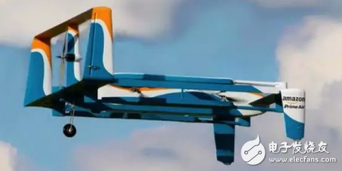



Misunderstanding:
Many users believe that liquid crystal displays can be divided into LEDs and LCDs. To some extent, this understanding is misguided by advertisements.
The LED display on the market is not a true LED display. To be precise, it is an LED-backlit Liquid Crystal Display. The liquid crystal panel is still a traditional LCD display. In a sense, this is somewhat fraudulent. nature! South Korea`s Samsung was once convicted by the British Advertising Association as violating the country`s advertising laws because its [LEDTV" LCD TVs were suspected of misleading consumers. For liquid crystal displays, the most important key is its LCD panel and backlight type, while the LCD panels of displays on the market generally use TFT panels, which are the same. The difference between LEDs and LCDs is only their backlight types: LED The backlight and CCFL backlight (that is, fluorescent lamps) are diodes and cold cathode lamps, respectively.
LCD is the acronym for Liquid Crystal Display, which means "liquid crystal display", that is, liquid crystal display. The LED display refers to a type of liquid crystal display (LCD), that is, a liquid crystal display (LCD) with LED (light emitting diode) as the backlight source. It can be seen that LCD includes LEDs. Corresponding to the LED display is actually a CCFL display.
(1) CCFL
Refers to a liquid crystal display (LCD) with CCFL (cold cathode fluorescent lamp) as the backlight source.
The advantage of CCFL display is good color performance, but the disadvantage is higher power consumption.
(2) LED
Refers to a liquid crystal display (LCD) that uses LEDs (light emitting diodes) as a backlight source, and generally refers to WLEDs (white light LEDs).
The advantages of LED displays are small size and low power consumption. Therefore, using LEDs as a backlight source can achieve high brightness while taking into account lightness and thinness. The main disadvantage is that the color performance is worse than that of CCFL monitors, so most professional graphics LCDs still use traditional CCFL as the backlight source.